CPAS Accurately Predicts Intensity of Super Typhoon Kong-rey 72 Hours Ahead
by Simon Tin and Yana Li
Typhoon Kong-rey made landfall in Taitung county along the southeast coast of Taiwan at about 2:00 pm (BJT) on 31 October 2024. Heavy rainfall and strong winds (approaching 200 km/h) hit the island as Kong-rey made landfall as a Strong Typhoon. Kong-rey weakened rapidly after landfall and moved into the Taiwan Strait with its central pressure higher than 975 hPa. Then Kong-rey moved northward along the coast of Fujian-Zhejiang with a weakening intensity of “Strong Tropical Storm - Tropical Storm.” It brought heavy rainfall over the coastal regions.
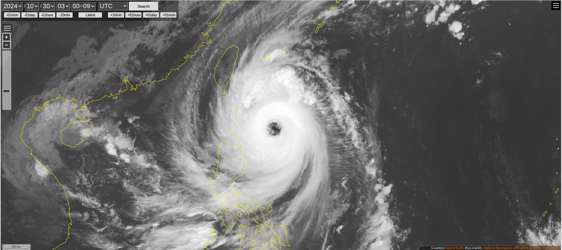
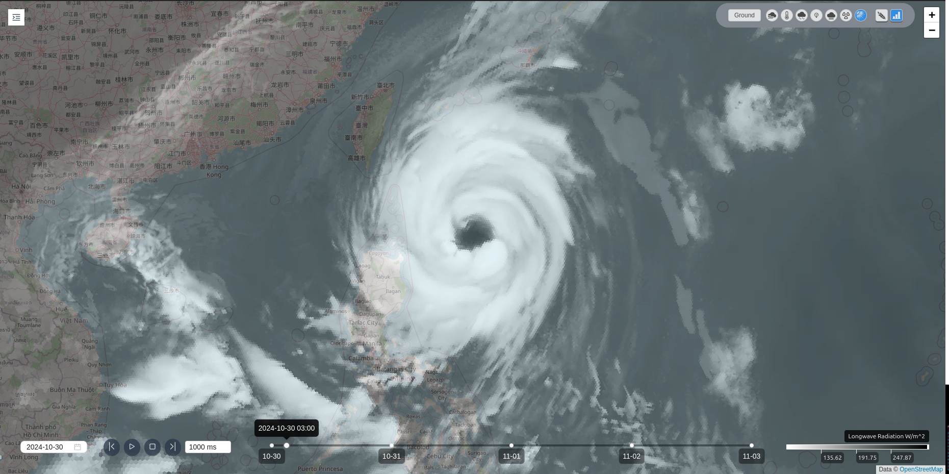
Typhoon Kong-rey reached the category of “Super Typhoon” before its landfall. The HIMAWARI-9 satellite image shows that Kong-rey had a concrete and round eye at 11:00 am on 30 October (BJT), demonstrating its strongest intensity around that time (Figure 1). CPAS forecast well captures this feature 27 hours ahead (Figure 1).
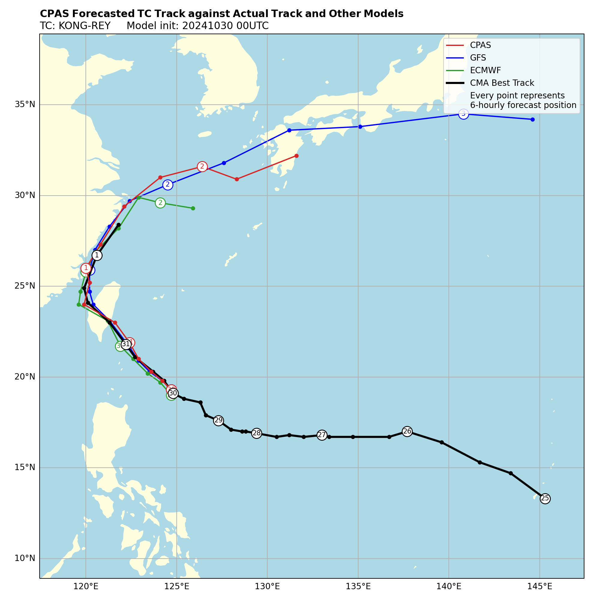
The development of Kong-rey is modulated mainly by the strong Western North Pacific Subtropical High. Because of such a strong background circulation, tracks of Kong-rey are consistent among predictions from CMA, ECMWF, GFS, and CPAS models (Figure 2). However, uncertainty in the typhoon intensity still exists among these operational models.
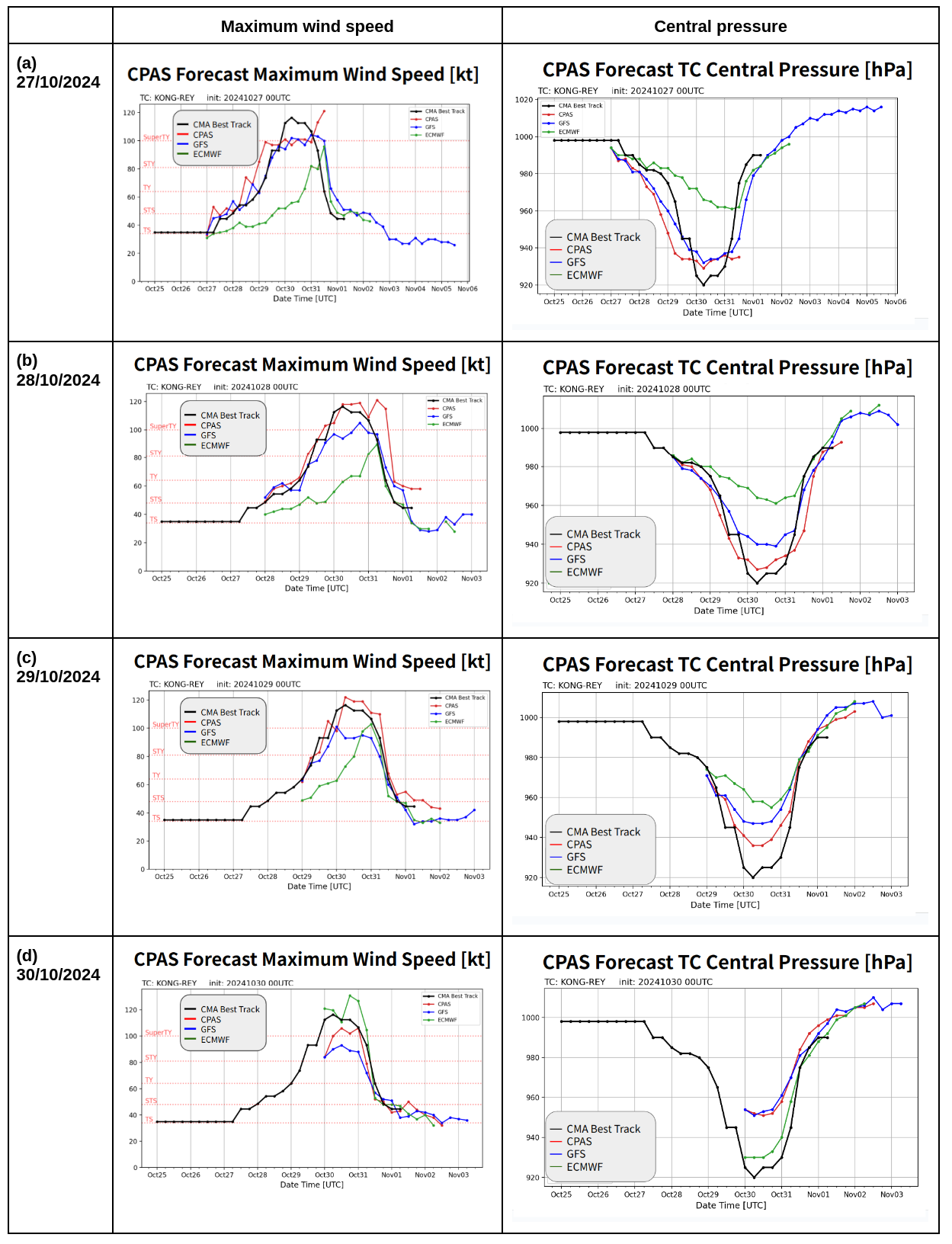
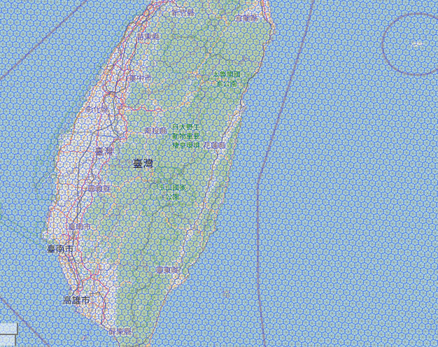
CPAS consistently outperformed ECMWF and GFS in predicting the evolution of Kong-rey’s intensity, indicated by its maximum wind speed and central pressure, closely matching observations. As early as 27 October (~72 hours ahead), CPAS has predicted that Kong-rey would reach a super typhoon, outperforming ECMWF and close to GFS (Figure 3a). Starting from 28 October, two days before reaching its maximum intensity, CPAS accurately predicted the intensity and timing of intensity changes compared to other operational models (Figure 3b, 3c). CPAS still shows some capability to predict high winds of Kong-rey with initial condition from GFS at 00 UTC on 30 October, while it follows the performance of GFS in predicting Kong-rey’s central pressure (Figure 3d). The overall good performance of CPAS in predicting the intensity of Kong-rey may lie in its high spatial resolution (5-9 km) along the typhoon track, especially around Taiwan and the adjacent ocean, which is about 4-5 km (Figure 4).
In summary, CPAS is capable of predicting the track and intensity of super typhoon Kong-rey longer than 72 hours in advance, outperforming ECMWF and GFS to some extent.
References:
Global Forecast System (GFS). (2024). National Centers for Environmental Information (NCEI). Retrieved 1st November 2024, from https://www.ncei.noaa.gov/products/weather-climate-models/global-forecast
International Best Track Archive for Climate Stewardship (IBTrACS). (2024). National Centers for Environmental Information (NCEI). Retrieved 1st November 2024, from https://www.ncei.noaa.gov/products/international-best-track-archive
Jaxa Himawari Monitor. (2024). Retrieved 1st November 2024, from https://www.eorc.jaxa.jp/ptree/index.html
中央气象台台风网. (2024). Retrieved 1st November 2024, from http://typhoon.nmc.cn/web.htm
