
Prediction of wind shear due to a spiral rain band of Tropical Cyclone Noul 2026 sweeping over Hong Kong International Airport
Authors: Chi-Chiu CHEUNG, Wai-Pang SZE
Proofreader: Alex HUI
Tropical Cyclone Noul (2026) formed in the northwest Pacific on July 23, 2026, and then gradually intensified, reaching the levels of a severe tropical storm and subsequently a typhoon in succession. The system approached the coast of Guangdong on 25 July. Its outer spiral rainbands precisely swept across the Hong Kong International Airport (HKIA) area. Wind shear signals were detected in monitoring around the airport, drawing significant attention from the aviation meteorology community.
We are conducting a daily run experiment for the 200-meter resolution CPAS model for predicting wind shear occurring in the Hong Kong International Airport (HKIA). The model is run twice a day, using 00Z and 12Z NCEP-GFS data as initial condition. We use limited computational resources which achieve a computational speed ratio of 1 : 4 (1 wall clock hour runs 4 simulated hours) and stream the simulation results to https://demo.cpas.earth/aviation/map.
The METAR stands for Meteorological Aerodrome Report. It’s a standardized, coded weather observation that gives near-real-time conditions at an airport or aerodrome. These reports are typically issued about every 30 minutes (often more frequently in rapidly changing weather) and are used by aircrew, air traffic services, and meteorological agencies to make decisions about flight operations. In particular, the METAR messages from HKIA (ICAO index VHHH) include Wind Shear (WS) information.
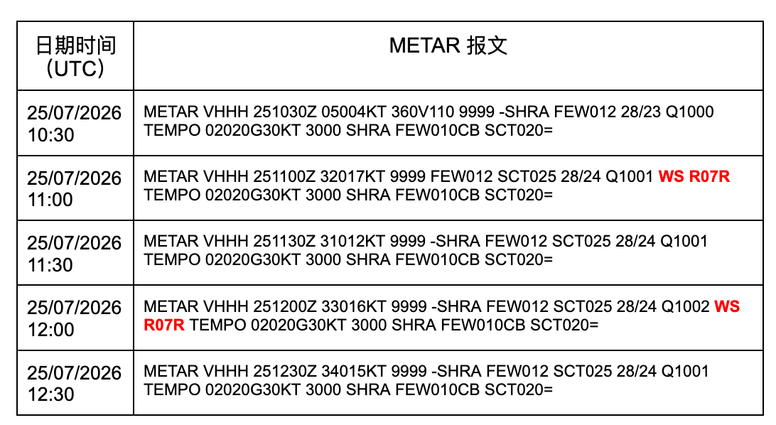
METAR message from 25/07/2026 10:30 to 25/07/2026 12:30. (METAR message queries from ogimet.com. See this page for the interpretation of METAR messages.)
Based on the messages, it is known that wind shears were reported in 30 minutes prior to 11:00Z and 12:00Z.
This period is covered by two CPAS runs, initialized at 2026-07-24 00Z (called 24_00 hereafter) and 12Z (called 24_12 hereafter) respectively. Each run uses the NCEP-GFS data as Initial Conditions for the CPAS global model which drives the 200m resolution regional model for HKIA.
We inspected the 24_00 global CPAS prediction results valid at Jul 25 10:00Z-12:00Z, which were pumped to the demo site at Jul 24 05:44Z - 05:48Z with a longer than 1 day lead time. It is found that CPAS simulated the core and spiral rain band of the TC.
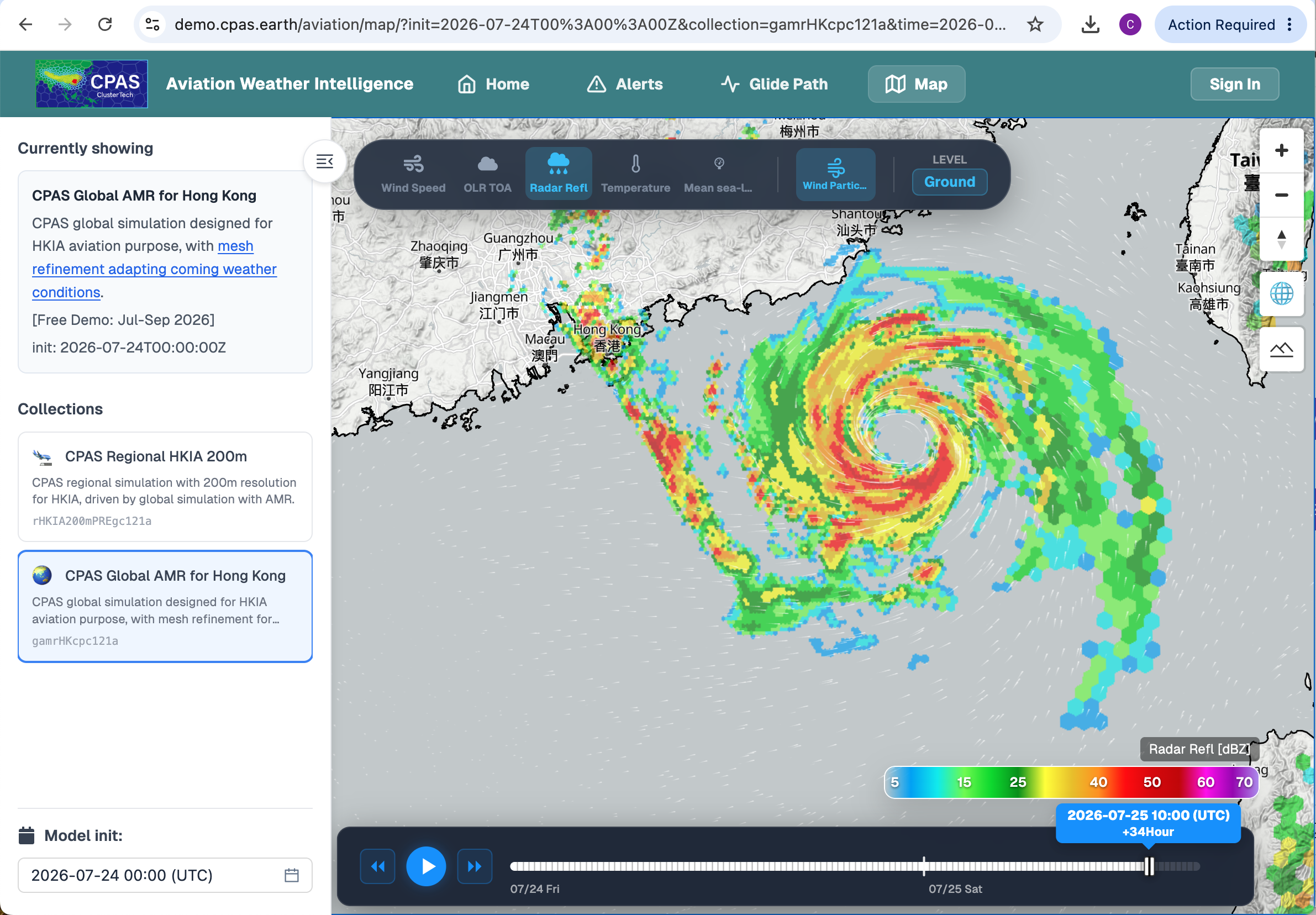
Radar Reflectivity of CPAS at 07-25_10:00UTC by 24_00 global run. Capture of the demo site viewable by this link.
The prediction results of the 200m-resolution regional model is available on Jul 24 13:06Z - 13:36Z, with a lead time of about 21 hours. The daily run experiment is run with limited computational resources and can be easily accelerated by throwing in more High-Performance-Computing (HPC) resources in production use (CPAS has good scalability). The 200m-resolution regional model shows a rain band as well:
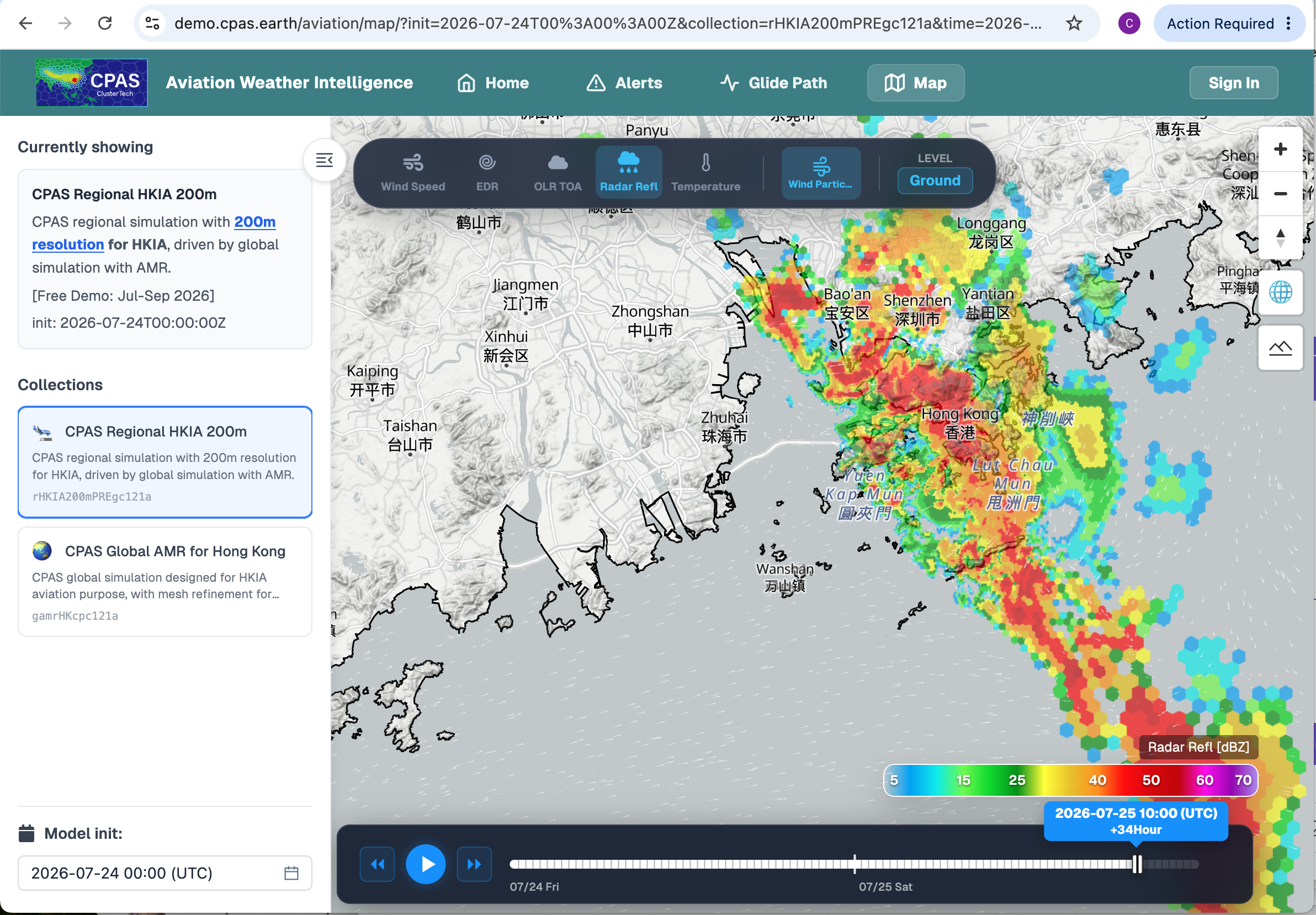
Radar Reflectivity of CPAS at 07-25_10:00UTC by 24_00 200m-resolution regional run. Capture of the demo site viewable by this link.
The 10-meter above-ground-level predicted wind field is depicted by:
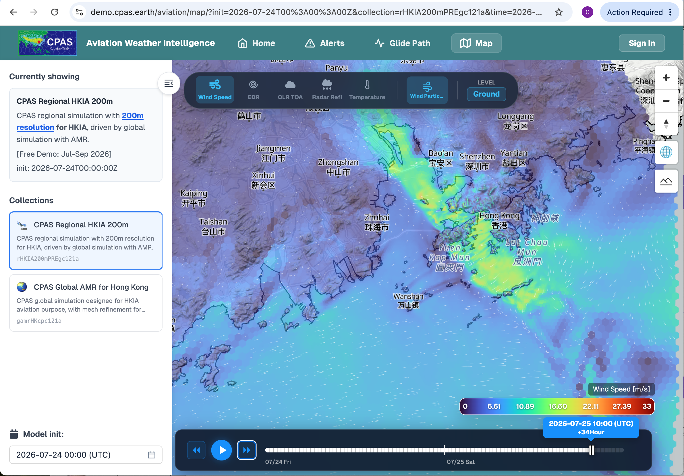
Or its zoom-in view
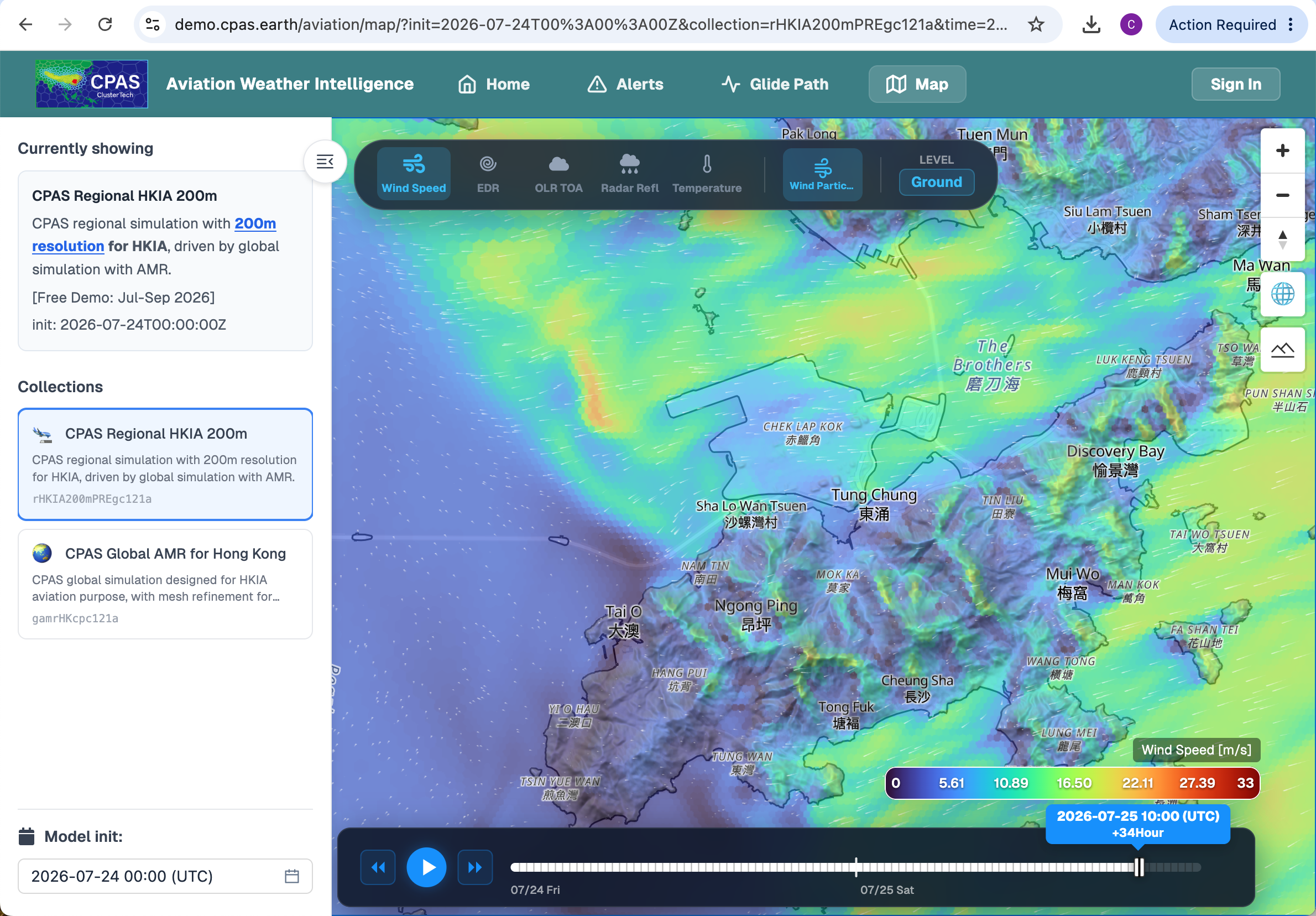
The 10-meter above-ground-level wind field of CPAS at 07-25_10:00UTC by 24_00 200m-resolution regional run. Capture of the demo site viewable by this link.
The CPAS simulation data is 3D. Interpolating forecasted wind (and Eddy Dissipation Rate, EDR, for indicating turbulence) data to glide paths of aircraft arrivals and departures, the head wind predicted to be encountered is depicted in the figure.
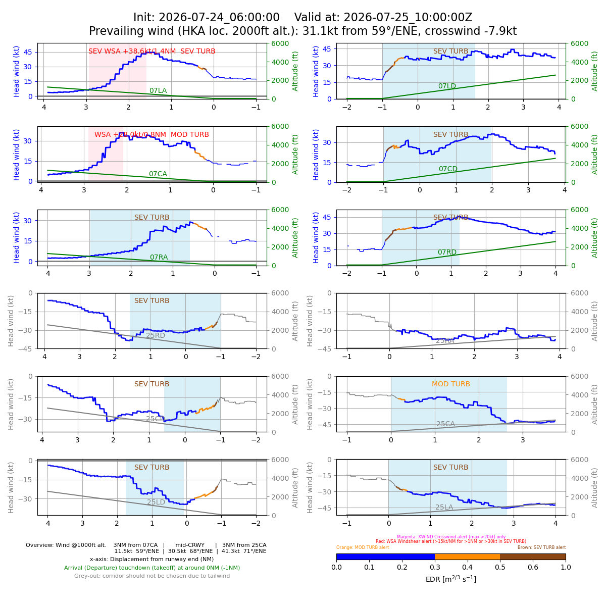
Here, wind shear is expected along all glide paths except 25RA. The 07CA and 07LA glide paths have exhibited wind-shear changes as great as +28.0kt/0.8NM and +38.6kt/1.4NM respectively. The timing error is half to one hour earlier with respect to the reported WS of the 11:00Z METAR record. This CPAS model run has a rather good prediction of the wind shear occurrence. (Remarks: The regional model was initialized with the “T+6hr” time slice of the CPAS global model, so the plotting tool label “Init: 2026-07-24_06:00:00”)
Readers are recommended to play around with the data visualization tool on the demo site, https://demo.cpas.earth/aviation/map. For the 24_12 run, the simulated rain band was less distinct:
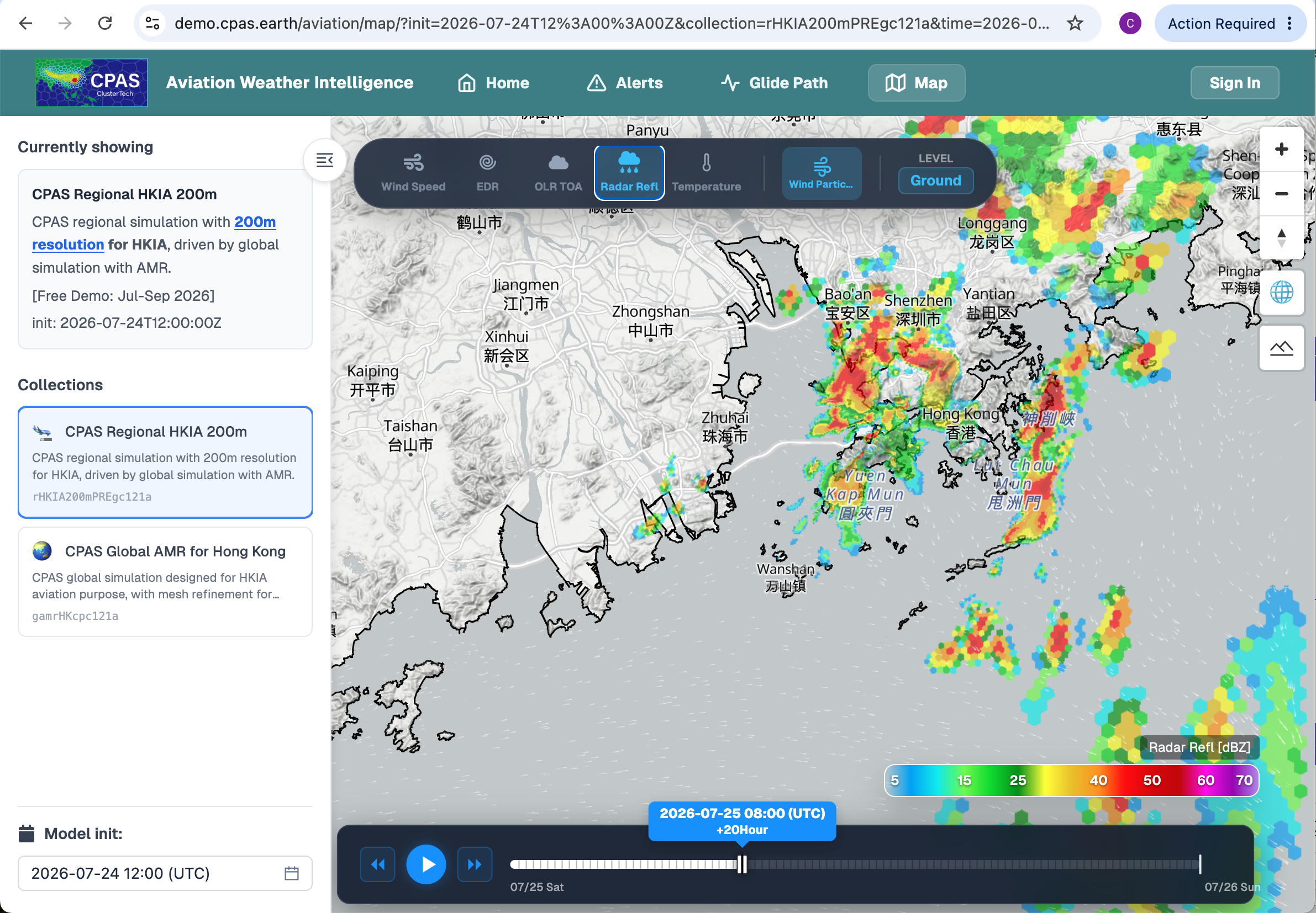
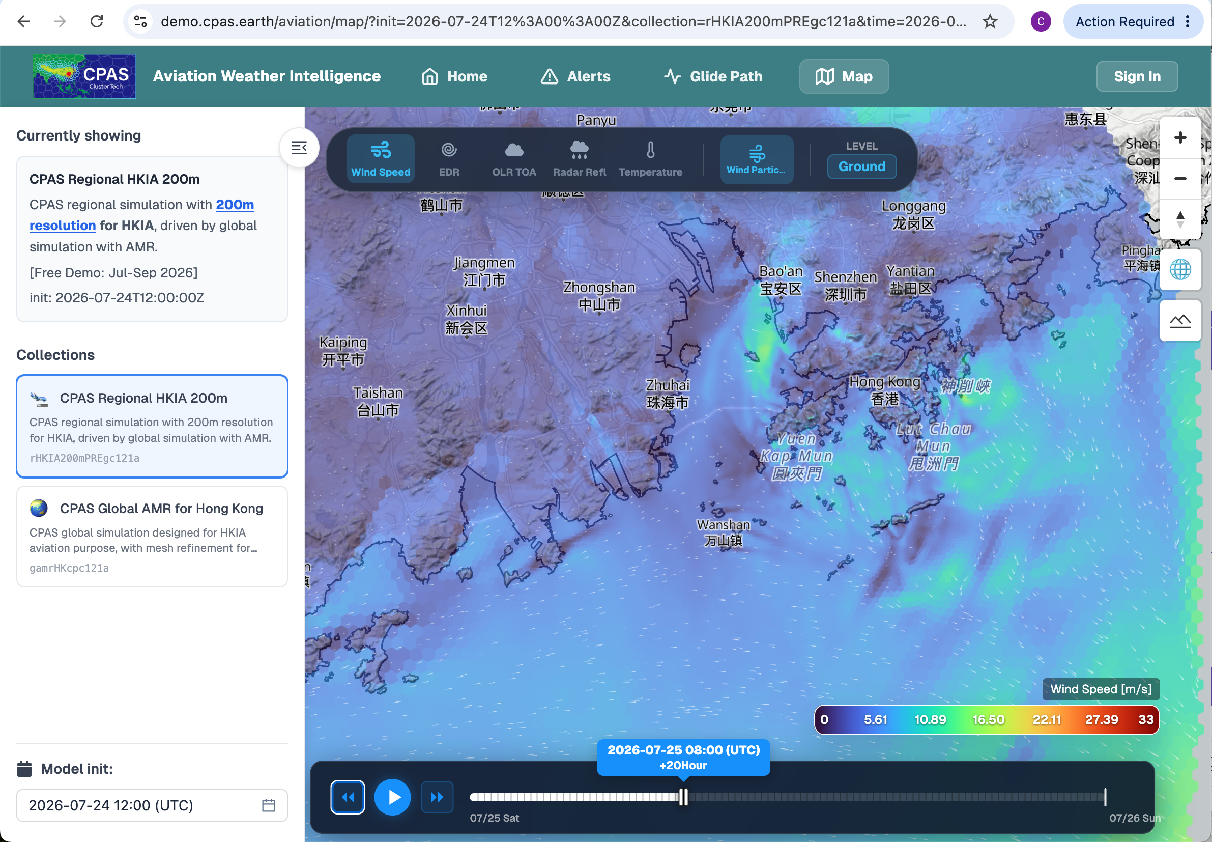
(Readers are recommended to operate the demo site interface to explore around the data)
No wind shear was detected from the forecasted 3D wind data from this 24_12 run.
To add a concluding remark to this article: As far as the authors understand, this is the first predictive wind shear alert system with about 1 day lead time. It is interesting to see that it exhibits high fidelity in simulating various phenomena occurring around HKIA. This rain band case is reported because the WS in the METAR record is identified to be associated with a distinct rain band sweeping over Hong Kong before the main body of TC Noul approached, and one of the two simulation results yielded a nice matched predicted wind shear signal. Further studies will focus on analysing predictions of WS due to flow over terrain.